 Version
2.0.4
Version
2.0.4
 Package Name
pl.com.taxussi.android.apps.mlas
Package Name
pl.com.taxussi.android.apps.mlas
 Category
Practical Tools
Category
Practical Tools
 Size
20.39MB
Size
20.39MB
Professional Forest Maps Numeral Browser for Android.
mLas mini is an application that allows you to reach a lot of information about the forest and the surrounding space.
It is used to display maps from various sources: geoportal.gov.pl, UMP-PCPL, as well as from data owned by the State Forests. Numerical data obtained from a specific forest inspectorate is needed to display the layers of the forest numerical map.
The mLas mini application is intended for work in the field - we recommend it in particular to foresters, as well as to all people who need to reach information about forests: surveyors, farmers, ecologists.
The author of the application (i.e. Taxus IT) supports various IT projects regarding broadly understood environmental protection - especially GIS in forestry, field work with GPS / GLONASS. mLas mini is a product similar to the Mlas Engineer application, which is widely used by foresters in Poland.
Application functionality:
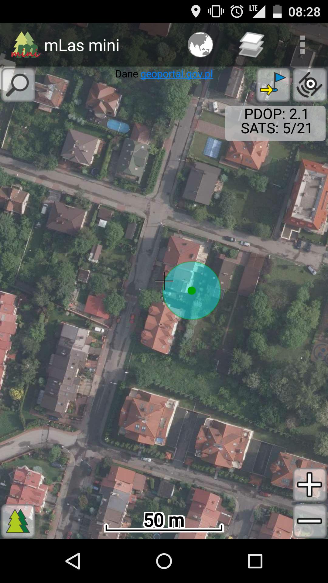
- displaying aerial and satellite photos (Map of Ortopofoto),
- display of a topographic map,
- Displaying the UMP -PCPL map - a detailed and numerical map of the terrain
- display of an economic map,
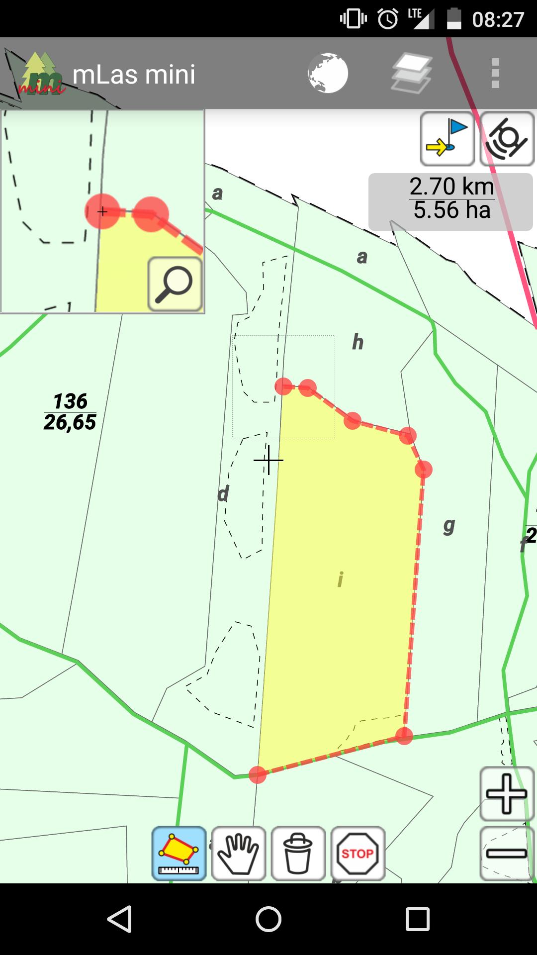
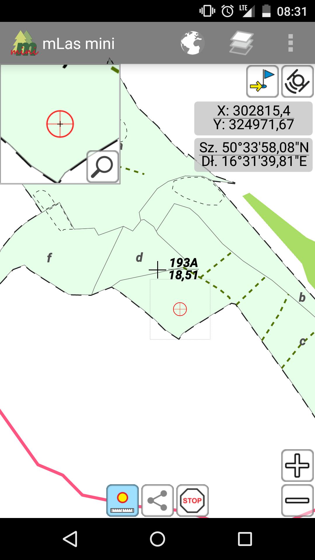
- displaying data from the Forest Numeric Map (LMN) of the State Forests,
- distance and surface measurements,
- searching for objects after the forest address
- displaying a taxable description (habitat and stand),
- GPS location - positioning and tracking positions
- measuring the coordinate of the point along with the possibility of data sharing
- adding target points with the possibility of sharing (Goto function)
- maps displayed from the WMTS service
- the size of the buttons adapted to the tablets
Minimum requirements:
- Android 4.0.3 (Ice Cream Sandwich)
- built -in disk memory or memory card
- screen diagonal: 4.0 "
- screen resolution: 480x800
GPS location:
- built -in GPS receivers,
- external GPS receivers via Bluetooth.
The application uses map data provided by external websites:
- map geoportal.gov.pl - http://www.geoportal.gov.pl
- Map of UMP -PCPL - http://ump.waw.pl
- Numerical terrain model - http://srtm.csi.cgiar.org


 Download APK(20.39MB)